01
Call or text
Tell us when and where the shot occurred, where the trail was last seen, and what you observed. We will gather the details needed to decide the next step.
Seasonal recovery service · Central Indiana
Lost the trail? ECM provides professional thermal drone deer recovery across Greenwood, Indianapolis, and Central Indiana.
How the service works
From the first call to the search result, the process stays focused, practical, and easy to understand.
Tell us when and where the shot occurred, where the trail was last seen, and what you observed. We will gather the details needed to decide the next step.
We review the location, timing, terrain, weather, foliage, and airspace, then build a focused flight plan around the most likely search area.
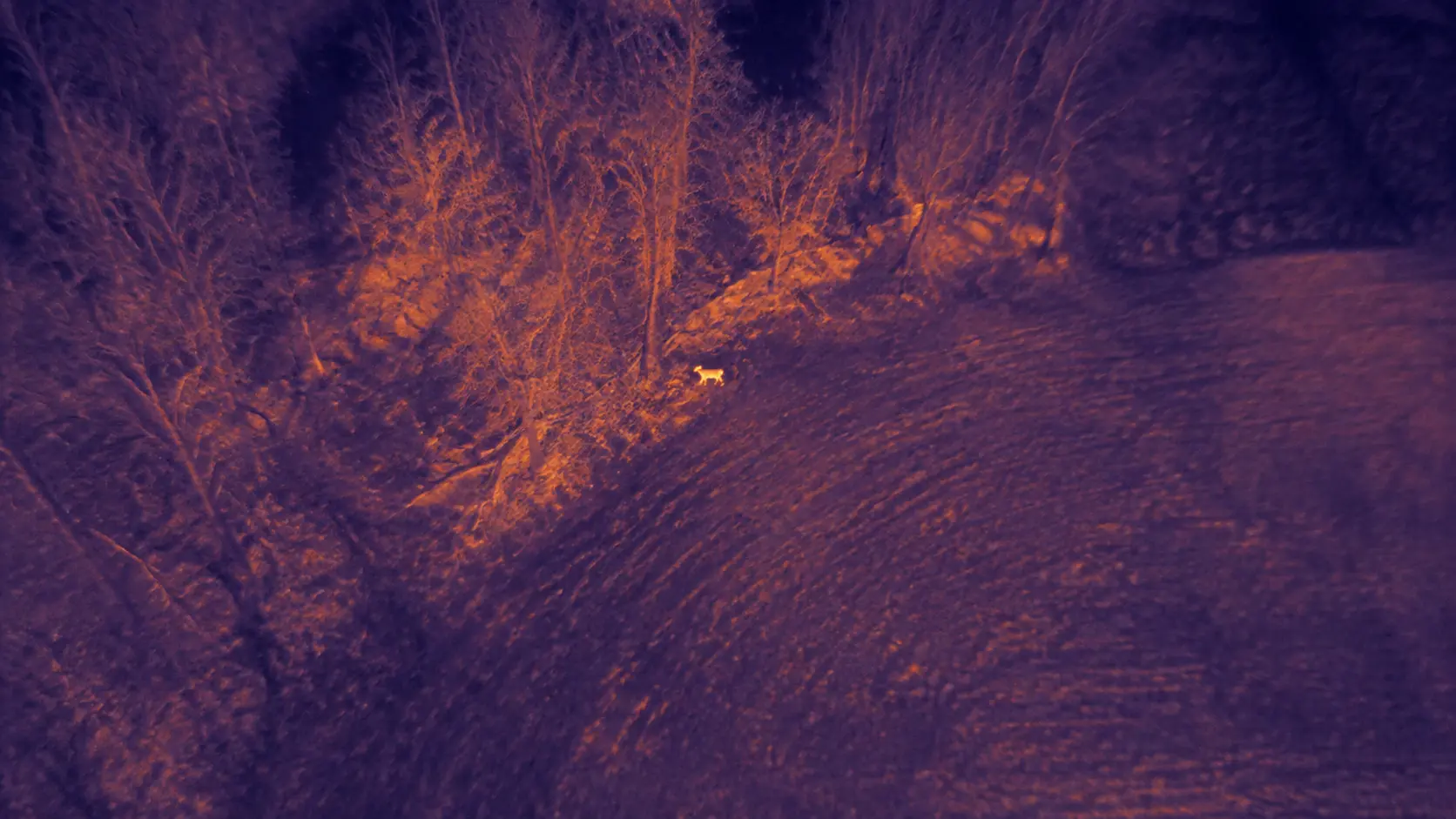
Using a DJI Enterprise drone equipped with thermal, visible, and zoom cameras, we scan the search area in a structured grid pattern to cover it as thoroughly as conditions allow.
We explain what was observed, share location information for potential targets, and help you understand the next practical step.
Time matters
Thermal searches are time-sensitive. Calling sooner gives ECM more opportunity to evaluate the search before body temperature, ground heat, weather, or continued movement reduce useful thermal contrast. We will ask for a few key details:
One professional search. No packages, finder fee, or outcome-based discount.
Check AvailabilityWhat the search includes
Why thermal can help
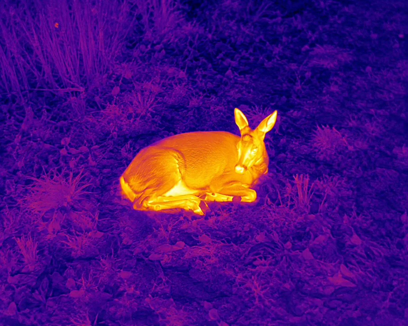
A thermal camera detects temperature differences rather than seeing a conventional color image. Under favorable conditions, that contrast can make an animal stand out from the surrounding terrain.
ECM uses a DJI Mavic 3 Thermal with a 640 × 512 thermal sensor, along with visible and zoom cameras to help evaluate potential targets.
Realistic expectations
Search results depend on what the camera can actually see and how clearly a heat signature separates from its surroundings.
They also cannot see through solid vegetation, structures, or other objects.
Dense leaf cover and evergreens can conceal a deer from the aircraft.
Rain, fog, temperature, and moisture can reduce useful visibility.
Ground, rocks, buildings, and retained daytime heat can resemble a target.
What improves a search
An accurate last-known location, cooler ground conditions, open canopy, and a reasonably focused search area give the thermal camera the best opportunity to evaluate the terrain. None guarantees a result.
Central Indiana service area
ECM Aerial Imaging is based in Greenwood and provides thermal drone deer recovery throughout the Indianapolis area and surrounding Central Indiana communities.
Standard pricing covers locations within 40 driving miles of Greenwood. Requests outside this area may still be accepted depending on distance, timing, availability, and the circumstances of the search. Additional travel charges may apply and will always be confirmed before dispatch. If you are outside our standard service area, contact us anyway and we will let you know if we can help.
Drone deer recovery is a seasonal service from ECM Aerial Imaging. Explore our other professional drone services.
Questions before dispatch
Still unsure whether a thermal search fits your situation? Call or text and we will walk through it with you.
Text ECM at 812-278-6047ECM charges $425 for a thermal drone deer recovery search within 40 driving miles of Greenwood, Indiana. Travel beyond 40 miles may be available depending on scheduling and availability, and any travel charge will be confirmed before dispatch.
Call or text as soon as practical after the deer has been lawfully shot and tracking has stalled. Early contact gives us time to review the shot, last-known location, weather, property boundaries, and whether current thermal conditions are suitable for a search. The best timing depends on the specific situation.
No. A thermal camera cannot see through trees, solid vegetation, or other objects. Openings in the canopy may provide a useful view, but dense leaf cover and evergreens can block a heat signature entirely.
Nighttime thermal deer recovery searches may be available when scheduling, weather, airspace, and operating conditions allow. ECM uses a DJI Mavic 3 Thermal with thermal, visual, and zoom capabilities for evening and night searches. Call or text for current availability.
The $425 core-area search includes up to approximately two hours of active search time after the first launch. Additional drone flights may be made during the same on-site search as conditions require. Travel, setup, permission confirmation, and preflight evaluation are separate from active search time.
We will ask for the property location, shot location, last-known location, time of the shot, direction of travel, what you observed, weather and tracking details, property boundaries, landowner permission, and any nearby hazards or access concerns. Accurate details help us plan a focused thermal drone deer recovery search.
Yes. Appropriate landowner permission must be established for the property where ECM will meet and operate. We will confirm access details and the requested search boundaries before flying.
ECM will not intentionally continue a search onto another property where required permission has not been established. If adjoining property may need to be searched, the appropriate permission must be obtained before that area is included.
ECM performs post-shot recovery work only for deer that were already lawfully shot before ECM became involved. Each search is subject to Indiana wildlife laws, FAA rules, property-access requirements, airspace restrictions, and other applicable limitations. ECM does not use drones to scout unshot wildlife or assist with hunting.
No. Customers are paying for a professional thermal search, not a guaranteed recovery. Terrain, foliage, weather, retained ground heat, search-area size, and the accuracy of the last-known location all affect the result.
ECM Aerial Imaging is based in Greenwood and focuses on Greenwood, Indianapolis, Johnson County, Marion County, Morgan County, Shelby County, and surrounding Central Indiana communities. Standard pricing is $425 within 40 driving miles of Greenwood. Travel beyond 40 miles may be available depending on availability, with any travel charge confirmed before dispatch.
Call or text for current availability
We will ask a few quick questions about the shot, location, timing, conditions, and search area—then let you know whether a thermal search is practical and whether we are available.